


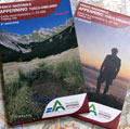
The cartography consists of two sheets, one for the west zone (Parma - Massa) and the other one for the east zone (Reggio - Luca), scale 1:25,000.
The reported information have been updated with useful news regarding the two slopes, in order to provide a useful instrument for hikers and an overview of the National Park.
This edition was realized thanks to the Italian Alpine Club from Tuscany and Emilia-Romagna.

The reported information have been updated with useful news regarding the two slopes, in order to provide a useful instrument for hikers and an overview of the National Park.
This edition was realized thanks to the Italian Alpine Club from Tuscany and Emilia-Romagna.
- Publisher: S.E.L.C.A.
- Size: Two sheets sized 13x21cm (folded up in a plastic envelope)
- Year: 2013
- Scale: 1:25.000
- Foreign language:


- Price: 15.00 €
Notes: It is possible to separately buy the West sheet Hiking Map (Parma - Massa) and the East sheet Hiking Map (Reggio - Lucca)
Item temporarily sold out at Emporio dei Parchi